Start at the top for an easy introduction. Go further down for more detail and scholarship.
- Easy
- Intermediate
- Advanced
For young readers
About 550 years ago, in the tall Andes Mountains of South America, the Inca people ruled a huge country. From north to south it stretched more than 4,000 kilometres. To hold it together, they built roads — thousands and thousands of kilometres of them.
These roads climbed over mountain passes higher than the Alps, crossed hot deserts along the Pacific Ocean, and wound through cloud forests. Where the mountains were steep, the builders cut stone steps. Where there were rivers and deep canyons, they hung bridges made of twisted grass ropes.
The Incas did not use wheels or horses. People walked, and llamas carried the loads — about as much as a heavy school backpack times five. Along the roads there were rest houses called tambos, where travellers could sleep and find food, cloth and firewood stored in warehouses.
Messages travelled fastest of all. Young runners called chasquis waited at little huts along the road. When one arrived, he passed his message — spoken words or a string of knots called a khipu — to the next runner, who dashed off. In this way news could travel up to a few hundred kilometres in a single day.
When Spanish soldiers arrived in 1532, they used the same roads to conquer the Inca Empire. Many roads were later forgotten or damaged, but about a quarter of them can still be seen.
Today Quechua-speaking villagers in Peru still rebuild one grass bridge, Q’eswachaka, by hand every year, singing and giving thanks to Mother Earth. In 2014 the Inca roads became a World Heritage Site shared by six countries.
At a glance
- Built
- Mainly c. 1438–1532 CE, during the expansion of the Inca Empire; incorporated older roads of the Wari, Tiwanaku, Chimú and other Andean peoples
- Length
- About 40,000 km is the most-cited figure; estimates range from about 23,000 to 60,000 km
- Extent
- Six modern countries: Colombia, Ecuador, Peru, Bolivia, Chile and Argentina; roughly 2 million km² and about 12 million people
- Centre
- Cusco, capital of Tawantinsuyu, “the land of four parts,” from which roads led into the four suyus
- Main routes
- Two north–south trunk roads — one through the highlands and one along the coast — linked by more than twenty cross-routes
- Infrastructure
- Paving, stairways, drainage, retaining walls, suspension and stone bridges, tambos (way stations), storehouses (qullqa), messenger posts
- Status
- UNESCO World Heritage Site “Qhapaq Ñan, Andean Road System” (2014); the Q’eswachaka bridge renewal is UNESCO Intangible Cultural Heritage (2013)
Easy
What was the Qhapaq Ñan?
The Inca road system was the largest transport network of the pre-Columbian Americas. Its Quechua name, Qhapaq Ñan, is often translated as “royal road” or “road of the powerful.” It was not a single highway but a web of roads, trails, stairways, causeways, bridges and buildings, stretching more than 4,000 kilometres from north to south along the Andes.
The roads served the Inca Empire, which its people called Tawantinsuyu, “the land of four parts.” From the capital, Cusco, four main roads ran out toward the four quarters of the empire: Chinchaysuyu to the northwest, Collasuyu to the southeast, Antisuyu to the east toward the Amazon, and Contisuyu to the southwest toward the Pacific.
The total length is usually given as about 40,000 kilometres, but estimates range from about 23,000 to 60,000 kilometres, depending on which routes are counted and how. Either way, the network linked an empire that covered nearly two million square kilometres and some twelve million people, from southern Colombia through Ecuador, Peru and Bolivia to central Chile and northwestern Argentina.
In 2014 UNESCO inscribed the network as a World Heritage Site under the name “Qhapaq Ñan, Andean Road System,” nominated jointly by all six of these countries.
Easy
A road through every kind of landscape
The Andes are among the most difficult places on Earth to build roads. Within a hundred kilometres a traveller can go from a coastal desert where it almost never rains, up through deep valleys, to high cold grasslands (the puna) above 4,000 metres, and down again into steamy forest. The Incas built routes through all of these.
Two long trunk roads formed the backbone. The highland road ran along the mountains from Quito through Cusco to the region around Lake Titicaca and beyond; the coastal road ran through the desert valleys of the Pacific shore. More than twenty cross-routes joined the two, climbing up and down the valleys between mountains and sea.
Some roads went to places that were sacred rather than practical. Mountains were apus, powerful beings in Andean belief, and roads led up some peaks to high shrines. On Mount Chañi in Argentina, a road climbed to the summit at almost 5,950 metres.
The most famous surviving stretch today is the Inca Trail to Machu Picchu, a stone path of about 42 kilometres that climbs to 4,215 metres at the pass called Warmiwañusqa before arriving at Machu Picchu through the Inti Punku, or Sun Gate.
Easy
How the roads were built
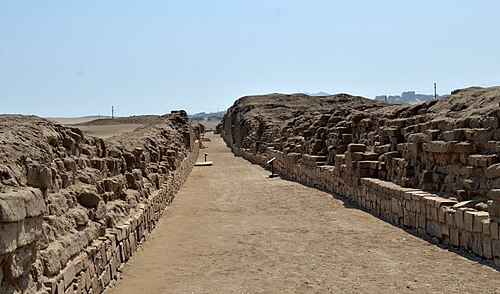
Inca engineers adapted each road to the ground. In the highlands, roads were often paved with carefully fitted stones. On the coast and the high puna, where stone was scarce or not needed, they used packed earth or sand, sometimes bordered by low walls or rows of stones to keep drifting sand off the path and mark the way.
Most roads were between one and four metres wide, but important routes were wider. The road leading into the administrative centre of Huánuco Pampa was about 25 metres wide, a statement of imperial power as much as a practical need. On steep slopes builders cut flights of stone stairs, which were perfect for people and llamas on foot.
Roads were protected from the heavy mountain rains by ditches, culverts and drains that carried water away, and by retaining walls that held up the roadbed on hillsides. Piles of stones called mojones marked distances and directions. These features help explain why some stretches survive after more than five centuries.
The work was done without iron tools, wheels or draft animals. Labour was organised through the mit’a, a system in which communities owed the state turns of work. Local people built and maintained the stretch of road that passed through their land.
Easy
Bridges of grass and stone
Rivers and gorges were crossed in many ways. Short gaps were bridged with stone slabs or wooden beams; wooden bridges had to be replaced regularly. Over wider canyons, the Incas built suspension bridges made of ropes twisted from grass and other plant fibres. Where no bridge could be built, travellers crossed in a hanging basket pulled along a cable, called an oroya.
Suspension bridges were among the wonders that most impressed Spanish observers, some of whom were afraid to cross them. The ropes rotted in the damp mountain air, so nearby communities had to rebuild the bridges every year or two as part of their labour duty.
One such bridge still exists: Q’eswachaka, about 28 metres long, spanning the Apurímac River in the Quehue District of Cusco Region, Peru. Every year, in the second week of June, four Quechua communities — Chaupibanda, Choccayhua, Huinchiri and Collana Quehue — gather to twist new ropes from ichu grass, take down the old bridge and weave a new one over a few days.
The builders see this as more than repair work. They honour their ancestors and Pachamama, Mother Earth, with offerings and ceremonies. Peru declared the tradition national cultural heritage in 2009, and UNESCO listed it as Intangible Cultural Heritage of Humanity in 2013.
Intermediate
Who travelled, and how: llamas, chasquis and tambos
The Qhapaq Ñan was a state road, not a public highway in the modern sense. Soldiers, porters, llama caravans, nobles and officials on government business were its main users. Ordinary subjects could travel on it only with permission, and bridges and important points were watched.
Goods moved on the backs of people and llamas. A llama of the short-haired q’ara type, still used in caravans today, can carry about 30 kilograms for some 20 kilometres a day. Caravans moved food, cloth, weapons and building materials between regions.
Information moved faster. Relay runners called chasquis were stationed at small posts along the roads, often said to be about half a league (roughly 2.5 kilometres) apart. Each runner carried a spoken message, a khipu — a record in knotted cords — or a small package to the next post, announcing his arrival with a conch-shell trumpet (pututu). Chroniclers reported that such relays could cover up to about 300 kilometres a day, and that fresh fish could be carried from the coast to the ruler in Cusco.
Every day’s walk or so along the road stood a tambo, a way station with lodging and storehouses. Larger administrative centres held long rows of storehouses called qullqa; Huánuco Pampa alone had 497 of them, with a capacity of some 37,100 cubic metres. Food, cloth and weapons stored there supported armies, officials and labourers, and could be redistributed in times of need.
Intermediate
Roads and the making of an empire
The Incas began as one of several peoples in the Cusco valley. According to Inca tradition and Spanish chronicles, the great expansion began around 1438 under the ruler Pachacuti, whose name means “turning of the world.” His son Topa Inca Yupanqui conquered the Chimú kingdom of the north coast and reached the region of Quito around 1463, and Huayna Capac extended Inca rule further north in the early 16th century.
Roads were essential to this expansion. They let armies move quickly and be fed from storehouses along the way; they let officials count people and goods, collect labour and tribute, and move whole communities (mitmaq) to new lands. The roads themselves, with their stairways, walls and tambos in Inca style, displayed the presence of the state in newly conquered territory.
The Inca economy worked without money or markets. It rested on reciprocity — the obligation to return work and gifts — and on the mit’a labour owed by communities to the state. In return, the state was expected to host feasts, provide food and drink to workers, and support people in hard times. Scholars debate how far this was genuine exchange and how far it disguised domination, but the road network was both the product and the tool of this system.
The Incas did not start from nothing. Many roads followed older routes built by earlier Andean states, especially the Wari of central Peru and Tiwanaku around Lake Titicaca, whose networks flourished between about the 6th and 12th centuries. What the Incas achieved was to connect, rebuild, standardise and expand these routes into a single system on a vastly greater scale.
Intermediate
Sacred roads and an ordered world
For Andean people, the landscape was alive. Mountains, springs, rocks and caves could be huacas — sacred places or beings — and the Inca state organised worship around them. Around Cusco, a system of imaginary lines called ceques radiated from the Temple of the Sun, linking hundreds of shrines that were cared for by different kin groups.
Roads were part of this sacred order. They connected Cusco, which Inca tradition regarded as the navel of the world, to the four quarters, and pilgrims and religious processions used them. Some roads climbed to mountain summits where offerings were made to the apus.
Building a road could also be a religious as well as political act. By extending the Qhapaq Ñan into a new region, the Incas were symbolically bringing it into the ordered world centred on Cusco and on the Inca ruler, who was considered a son of the Sun (Inti).
Many of these beliefs survive, transformed, in Andean communities today. Offerings to Pachamama and to the mountains continue to accompany work such as the rebuilding of Q’eswachaka, and many people still regard the old roads as places connected to their ancestors.
Intermediate
Conquest, colonial use and decline
In 1532 a small Spanish force led by Francisco Pizarro entered an empire weakened by a civil war between the brothers Huáscar and Atahualpa, and by epidemic disease that had arrived ahead of the Europeans. The Spaniards marched along Inca roads to Cajamarca, where they captured Atahualpa; he was executed in 1533. Later expeditions, such as Diego de Almagro’s march to Chile in 1535–1536, also largely followed the Qhapaq Ñan.
The roads that had held the empire together thus helped to conquer it. Inca resistance continued from the jungle stronghold of Vilcabamba until 1572. Meanwhile, the Spanish chronicler Pedro Cieza de León, who travelled the roads in the 1540s, praised them as among the greatest works in the world and noted that even where they were broken and ruined, they showed how great they had once been.
Under colonial rule the network decayed. The Indigenous population collapsed — from perhaps twelve million to around one million within about fifty years — because of epidemics, war and forced labour, destroying the community labour that maintained the roads. Horses, mules and carts were poorly suited to stairways and grass bridges, and colonial trade was redirected toward mines and coastal ports rather than the Inca system of redistribution.
The Spanish also transformed the Inca mit’a into a brutal system of forced labour, most notoriously in the silver mines of Potosí. For many Andean communities the colonial period meant the loss of the reciprocal bonds that had once given the road system its meaning. Today about a quarter of the old network remains visible.
Intermediate
The roads today: heritage, tourism and living use
Parts of the Qhapaq Ñan are still used every day by rural communities who walk, herd animals and carry goods along them. In many places the old road is simply the local path, and villagers repair it as their ancestors did. The UNESCO nomination emphasised this living character, and the six countries committed to working with local communities in managing the sites.
Tourism has made some stretches famous. The Inca Trail to Machu Picchu is so popular that Peru limits access to 500 people a day, including only about 200 trekkers, and closes the trail each February for maintenance. Tourism brings income but also crowding, erosion and debates about who benefits.
The roads also have long-term economic effects. A 2021 study found that communities within about 20 kilometres of the old Inca roads still had higher wages, better nutrition and more schooling than similar communities farther away — an example of how infrastructure can shape a region for centuries.
Conservation of such a vast and scattered monument is a major challenge. Mining, new highways, urban growth, looting and natural erosion threaten many sections, and the stretch of land covered by the World Heritage listing is only a small fraction of the whole network.
Advanced
Scholarly debates: length, purpose and pre-Inca foundations
Estimates of the network’s length vary widely, from about 23,000 to 60,000 kilometres. The differences come from what counts as an “Inca road” — only formally constructed routes, or also informal trails used in Inca times — and from how thoroughly regions have been surveyed. John Hyslop’s field survey, published as The Inka Road System (1984), remains a foundational work, but much of the network has still not been systematically recorded.
Scholars also debate the relative importance of the roads’ functions. Some emphasise military logistics and state control; others stress administration and the movement of goods and labour; still others highlight religious and symbolic meanings, arguing that roads created a sacred geography centred on Cusco. These views are not exclusive, and different roads probably served different purposes.
A third debate concerns continuity. How much of the network was new construction, and how much was the reuse of Wari, Tiwanaku, Chimú and other earlier routes? Archaeological dating of road segments is difficult, since roads leave few datable remains, and Inca rebuilding may have erased earlier phases. Many researchers now see the Qhapaq Ñan as the culmination of more than a thousand years of Andean road building.
Finally, historians reassess the chroniclers. Accounts by Spaniards such as Cieza de León and Polo de Ondegardo, and by writers of Andean descent such as Garcilaso de la Vega and Felipe Guaman Poma de Ayala, provide vivid details — about chasqui speeds, bridge maintenance and road officials — but each wrote with his own purposes. Garcilaso, for example, wrote in Spain decades later to present Inca civilisation in a favourable light, while Guaman Poma wrote to protest colonial abuses.
Advanced
Evidence and methods
Research on the Qhapaq Ñan combines field archaeology, remote sensing, historical documents and ethnography. Surveys on foot map surviving road segments, walls, stairs, drains and tambos; satellite imagery, aerial photographs and more recently lidar help trace roads across remote terrain.
The Inca did not write in the European sense, but they recorded information in khipus. Most khipus cannot yet be fully read, especially their narrative content, so the written record of the roads comes mainly from colonial sources: chronicles, administrative inspections (visitas), and lawsuits in which Indigenous communities described their obligations to maintain roads and bridges.
Ethnography — the study of living communities — is also valuable. Practices such as the rebuilding of Q’eswachaka, the organisation of llama caravans and communal work parties show techniques and social arrangements that may resemble those of Inca times, though scholars caution against assuming that present practices are unchanged survivals.
The 2014 World Heritage nomination was itself a major research project, coordinated among six countries, which documented hundreds of archaeological sites and many hundreds of kilometres of road. It also raised questions about how to manage a transnational, linear monument that passes through many communities with different needs and histories.
Key ideas
- Integration of a vertical world
- The roads linked coast, highlands and forest, letting the Incas move goods and people between very different ecological zones.
- Reciprocity and mit’a
- Roads were built and maintained through rotating labour owed by communities to the state, which in turn was expected to feed workers and support its subjects.
- Communication without writing
- Chasqui runners and knotted khipu records moved information across the empire with remarkable speed.
- Infrastructure as power
- Roads, tambos and storehouses made the state present everywhere, enabling armies, administration and the relocation of populations.
- Sacred geography
- Roads connected Cusco, the centre of the Inca world, to shrines, mountains and the four quarters, giving travel religious meaning.
- Andean continuity
- The Incas built on older networks of the Wari, Tiwanaku and others, and Andean communities still use and maintain parts of the roads.
- Double-edged legacy
- The same roads that unified the empire helped the Spanish conquer it, and today they bring both heritage pride and the pressures of tourism.
Records
- c. 600 CE — Wari and Tiwanaku states build road networks in the central Andes and around Lake Titicaca (c. 6th–12th centuries).
- c. 1438 — Traditional date for the start of Inca expansion under Pachacuti.
- c. 1463 — Topa Inca Yupanqui conquers the Chimú and reaches the region of Quito.
- c. 1493 — Huayna Capac becomes ruler and extends the empire northward.
- 1532 — Pizarro’s force marches along Inca roads to Cajamarca and captures Atahualpa.
- 1535 — Diego de Almagro’s expedition to Chile follows the Inca road southward.
- 1553 — Pedro Cieza de León publishes the first part of his Chronicle of Peru, describing the roads.
- 1572 — Fall of Vilcabamba, the last Inca stronghold.
- 1609 — Garcilaso de la Vega publishes the Comentarios Reales, with accounts of roads and chasquis.
- 1984 — John Hyslop publishes his survey The Inka Road System.
- 2013 — UNESCO lists the annual renewal of the Q’eswachaka bridge as Intangible Cultural Heritage.
- 2014 — “Qhapaq Ñan, Andean Road System” is inscribed as a World Heritage Site by six countries.
Glossary
- Qhapaq Ñan
- Quechua name of the Inca road system, “royal road” or “road of the powerful.”
- Tawantinsuyu
- The Inca name for their empire, “the land of four parts.”
- Suyu
- One of the four quarters of the empire: Chinchaysuyu, Collasuyu, Antisuyu and Contisuyu.
- Chasqui
- A relay runner who carried messages, khipus or small packages along the roads.
- Khipu (quipu)
- A device of knotted cords used by Andean peoples to record numbers and possibly other information.
- Tambo
- A way station along the road with lodging and storehouses for travellers on state business.
- Qullqa
- An Inca storehouse, often built in long rows at administrative centres.
- Mit’a
- Rotating labour service owed by communities to the Inca state; later turned into forced labour under Spanish rule.
- Huaca
- A sacred place, object or being in Andean religion, such as a mountain, spring or rock.
- Apu
- A mountain regarded as a powerful spirit or deity in Andean belief.
Questions and answers
How long were the Inca roads?
About 40,000 kilometres is the usual figure, but estimates range from about 23,000 to 60,000 kilometres depending on what is counted.
Did the Incas use wheels or horses on their roads?
No. There were no horses in the Americas before the Spanish came, and wheeled vehicles were not used for transport. People walked and llamas carried loads, which is why roads could include steep stone stairs.
How fast could a message travel?
Relay runners called chasquis could carry messages up to about 300 kilometres in a day, according to chroniclers, handing them from runner to runner at posts along the road.
Can you still walk on the Inca roads?
Yes. About a quarter of the network is still visible, and many rural communities use parts of it every day. The Inca Trail to Machu Picchu is the most famous stretch for hikers.
Is there still an Inca rope bridge?
Yes. Quechua communities rebuild the Q’eswachaka bridge over the Apurímac River every June using grass ropes, with ceremonies honouring their ancestors and Mother Earth.
Did the Incas build all of these roads themselves?
No. Many routes followed older roads built by earlier Andean states such as the Wari and Tiwanaku. The Incas connected, rebuilt and greatly expanded them into one system.
How reliable are the Spanish descriptions of the roads?
They are valuable but must be read critically. Chroniclers wrote with different goals, sometimes years after the events, and archaeology is needed to test their claims.
Sources and further reading
- Inca road system. Wikipedia
- Inca Empire. Wikipedia
- Chasqui. Wikipedia
- Q'eswachaka. Wikipedia
- Inca Trail to Machu Picchu. Wikipedia
- 잉카 도로 체계. 위키백과
- John Hyslop, The Inka Road System. Academic Press, 1984
- Terence N. D’Altroy, The Incas. Blackwell, 2002
- Ramiro Matos Mendieta and José Barreiro (eds.), The Great Inka Road: Engineering an Empire. Smithsonian Books, 2015
Related
- Machu PicchuInca settlement in the Andes, probably established in the fifteenth century.
- Túpac Amaru IIAndean kuraka of Inca descent who in 1780 led the largest anti-colonial uprising of 18th-century Spanish America, executed in Cusco in 1781.
- Chavín de HuántarHighland Peruvian temple complex of the first millennium BC whose dark stone galleries lead to the Lanzón, a fanged granite deity; centre of the first art style shared across much of the Andes.
- Nazca LinesLarge ground drawings and lines made by ancient communities in the desert of southern Peru.
- CaralPlanned preceramic city of stone platform pyramids and sunken circular plazas on the Peruvian coast, built c. 2600–2000 BC and often called the oldest city in the Americas.
Written with AI assistance from the published sources listed above, and revised as new research appears.